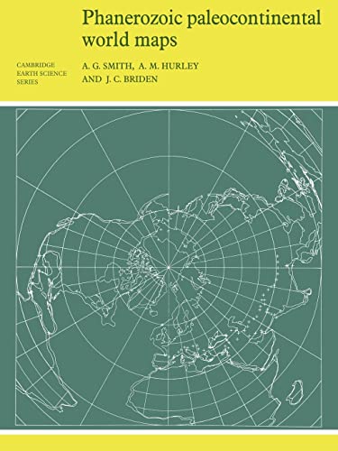
This 1980 book shows the positions of the major continental areas during the past 560 million years as four series of computer-drawn maps, which provide a framework on which a wide variet… Mehr…
This 1980 book shows the positions of the major continental areas during the past 560 million years as four series of computer-drawn maps, which provide a framework on which a wide variety of data may be plotted. Cylindrical equidistant and Lambert equal-area polar projections are used, with a thirty-degree latitude-longitude grid. Bücher > Fremdsprachige Bücher > Englische Bücher 280 x 210 x 6 mm , Cambridge University Press, Taschenbuch, Cambridge University Press<
Orellfuessli.ch
Nr. A1017282138. Versandkosten:Lieferzeiten außerhalb der Schweiz 3 bis 21 Werktage, , Versandfertig innert 4 - 7 Werktagen, zzgl. Versandkosten. (EUR 18.67) Details...
(*) Derzeit vergriffen bedeutet, dass dieser Titel momentan auf keiner der angeschlossenen Plattform verfügbar ist.
This 1980 book shows the positions of the major continental areas during the past 560 million years as four series of computer-drawn maps. Media > Book, [PU: Cambridge University Press]
BetterWorldBooks.com
used in stock. Versandkosten:zzgl. Versandkosten. Details...
(*) Derzeit vergriffen bedeutet, dass dieser Titel momentan auf keiner der angeschlossenen Plattform verfügbar ist.
This 1980 book shows the positions of the major continental areas during the past 560 million years as four series of computer-drawn maps, which provide a framework on which a wide variet… Mehr…
This 1980 book shows the positions of the major continental areas during the past 560 million years as four series of computer-drawn maps, which provide a framework on which a wide variety of data may be plotted. Cylindrical equidistant and Lambert equal-area polar projections are used, with a thirty-degree latitude-longitude grid. Bücher > Fremdsprachige Bücher > Englische Bücher 280 x 210 x 6 mm , Cambridge University Press, Taschenbuch, Cambridge University Press<
Nr. A1017282138. Versandkosten:Lieferzeiten außerhalb der Schweiz 3 bis 21 Werktage, , Versandfertig innert 4 - 7 Werktagen, zzgl. Versandkosten. (EUR 18.67)
This 1980 book shows the positions of the major continental areas during the past 560 million years as four series of computer-drawn maps. Media > Book, [PU: Cambridge University Press]
1Da einige Plattformen keine Versandkonditionen übermitteln und diese vom Lieferland, dem Einkaufspreis, dem Gewicht und der Größe des Artikels, einer möglichen Mitgliedschaft der Plattform, einer direkten Lieferung durch die Plattform oder über einen Drittanbieter (Marketplace), etc. abhängig sein können, ist es möglich, dass die von eurobuch angegebenen Versandkosten nicht mit denen der anbietenden Plattform übereinstimmen.
This 1980 book shows the positions of the major continental areas during the past 560 million years as four series of computer-drawn maps.
Detailangaben zum Buch - Phanerozoic Paleocontinental World Maps
EAN (ISBN-13): 9780521232586 ISBN (ISBN-10): 0521232589 Taschenbuch Erscheinungsjahr: 1981 Herausgeber: Cambridge University Press 106 Seiten Gewicht: 0,259 kg Sprache: eng/Englisch
Buch in der Datenbank seit 2007-03-27T12:52:43+02:00 (Berlin) Detailseite zuletzt geändert am 2023-06-26T12:16:49+02:00 (Berlin) ISBN/EAN: 0521232589
ISBN - alternative Schreibweisen: 0-521-23258-9, 978-0-521-23258-6 Alternative Schreibweisen und verwandte Suchbegriffe: Autor des Buches: smith, hurley, bride Titel des Buches: phanerozoic, world maps three, map
Weitere, andere Bücher, die diesem Buch sehr ähnlich sein könnten: